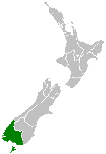
File:Position of Southland Region.png
Appearance
Position_of_Southland_Region.png (405 × 590 pixels, file size: 7 KB, MIME type: image/png)
File history
Click on a date/time to view the file as it appeared at that time.
| Date/Time | Thumbnail | Dimensions | User | Comment | |
|---|---|---|---|---|---|
| current | 07:41, 27 April 2005 |  | 405 × 590 (7 KB) | Domie~commonswiki | Region of New Zealand, position on the map (source:English Wiki) {{PD}} Category:Maps of New Zealand |
File usage
The following 99 pages use this file:
- Anchorage Island (New Zealand)
- Anderson Park, Invercargill
- Bench Island (New Zealand)
- Betsy Island (New Zealand)
- Big Bay (New Zealand)
- Big Island (New Zealand)
- Birchwood, New Zealand
- Bird Island (Southland)
- Bishop and Clerks Islands
- Blackmount
- Blue Gum Island
- Boat Group
- Boat Passage Islands
- Bombay Rock (New Zealand)
- Bragg Nugget
- Bravo Island
- Breaksea Islands (Foveaux Strait)
- Breaksea Islands (Stewart Island)
- Browns, New Zealand
- Bull and Cow Islands
- Charlton, New Zealand
- Chatton, New Zealand
- Clifden Limestone Caves
- Drummond, New Zealand
- Eyre Mountains / Taka Ra Haka Conservation Park
- Fairfax, New Zealand
- Fortification, New Zealand
- Garston, New Zealand
- Glencoe, New Zealand
- Glenham, New Zealand
- Gore Aerodrome
- Great South Basin
- Green Island (Foveaux Strait)
- Greenhills, New Zealand
- Halfmoon Bay (Stewart Island)
- Harrison River (New Zealand)
- Heddon Bush
- Hokonui, New Zealand
- Isla Bank
- Kapuka South
- Kepler Mire
- Knapdale, New Zealand
- Lake Henry (New Zealand)
- Lake Quill
- Limehills
- Lochiel, New Zealand
- Longbush, Southland
- Longwood Range
- Lorneville, New Zealand
- Maitland, New Zealand
- Mataura Island
- Mavora Lakes
- Menzies Ferry
- Mount Allen (Stewart Island)
- Mount Anglem
- Mount Axford
- Mount Franklin (Southland)
- Mount Pye (New Zealand)
- Murihiku
- Niagara Falls (New Zealand)
- Old Man Range
- Oreti Beach
- Otama, Southland
- Oteramika
- Pearl Harbour, New Zealand
- Pine Bush, New Zealand
- Porpoise Bay (New Zealand)
- Pukerau
- Pukewao
- Rakahouka
- Rakatu Wetlands
- Raratoka Island
- Rockdale, New Zealand
- Roslyn Bush
- Seaward Downs
- South Cape / Whiore
- Southland County
- Springhills
- Surrey Park
- Takitimu Mountains
- Te Peka
- Te Tipua
- Te Waewae Bay
- Timpanys
- Titiroa
- Toetoes Bay
- Tuturau
- Waikawa, Southland
- Waimatuku
- Waimea Plain (Southland)
- Waipapa Point
- Wairaki River
- Wairio
- Waitane
- Waituna Lagoon
- Wallace County, New Zealand
- West Invercargill
- White Hill Wind Farm
- Template:Southland-geo-stub
Global file usage
The following other wikis use this file:
- Usage on eo.wikipedia.org
- Usage on eu.wikipedia.org
- Usage on fa.wikipedia.org
- Usage on fi.wikipedia.org
- Usage on gd.wikipedia.org
- Usage on hi.wikipedia.org
- Usage on ja.wikipedia.org
- Usage on ko.wikipedia.org
- Usage on mi.wikipedia.org
- Waihōpai
- Template:Maramara matawhenua (Murihiku)
- Te Oneroa
- Cromarty
- Port Craig
- Kilbride
- The Key
- Ōrauwea
- Blackmount
- Monowai
- Woodlaw
- Wairio
- Eastern Bush
- Feldwick
- Piko Piko
- Merrivale
- Clifden
- Pukemaori
- Waikouro
- Scotts Gap
- Raymonds Gap
- Otahu Flat
- Bayswater
- Opio
- Tinkertown
- Crawfords
- Birchwood
- Aparima
- Pahia
- Wakapatu
- The Rocks
- Taramea Bay
- New Windsor
- Longwood
- Ōtaetae
- Waipango
- Gummies Bush
- Orepuki
- Waihoaka
- Gropers Bush
- Ermedale
View more global usage of this file.

