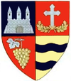
Archiș
Archiș | |
|---|---|
 Location in Arad County | |
| Coordinates: 46°28′59″N 22°3′0″E / 46.48306°N 22.05000°E | |
| Country | Romania |
| County | Arad |
| Population (2021-12-01)[1] | 1,333 |
| Time zone | EET/EEST (UTC+2/+3) |
| Vehicle reg. | AR |
Archiș (Hungarian: Bélárkos) is a commune in Arad County, Romania. It is situated in the northern part of the Sebiș Basin, at the foot of the Codru Moma Mountains, and its surface is 68.07 km2. It is composed of four villages: Archiș (situated at 84 km from Arad), Bârzești (Barzafalva), Groșeni (Tönköd) and Nermiș (Nermegy).
Population
[edit]According to the 2002 census, the population of the commune is 1699. Ethnically, it has the following structure: 94.9% are Romanians, 0.2% Hungarians, 4.4% Roma and 0.5% are of other or undeclared nationalities.
History
[edit]The first documentary record of Archiș dates back to 1552. Bârzești, Groșeni and Nermiș were mentioned in documents in 1580.
Economy
[edit]Although the economy of the commune is mainly agricultural, the secondary and tertiary economic sectors have also developed since the 1990s.
Tourism
[edit]Among the commune's tourist attractions are the landscape at the western edge of Codru-Moma Mountains and the church of Pious Paraschiva (1725).


