Bellou-en-Houlme
Bellou-en-Houlme | |
|---|---|
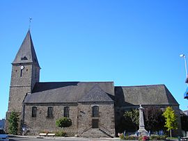
 The church in Bellou-en-Houlme | |
| Coordinates: 48°41′29″N 0°26′32″W / 48.6914°N 0.4422°W | |
| Country | France |
| Region | Normandy |
| Department | Orne |
| Arrondissement | Argentan |
| Canton | La Ferté-Macé |
| Intercommunality | CA Flers Agglo |
| Government | |
| • Mayor (2020–2026) | Jean-Marie Gaudin[1] |
Area 1 | 38.73 km2 (14.95 sq mi) |
| Population (2022)[2] | 1,031 |
| • Density | 27/km2 (69/sq mi) |
| Time zone | UTC+01:00 (CET) |
| • Summer (DST) | UTC+02:00 (CEST) |
| INSEE/Postal code | 61040 /61220 |
| Elevation | 202–332 m (663–1,089 ft) (avg. 221 m or 725 ft) |
| 1 French Land Register data, which excludes lakes, ponds, glaciers > 1 km2 (0.386 sq mi or 247 acres) and river estuaries. | |
Bellou-en-Houlme is a commune in the Orne department in northwestern France.[3]
Geography
[edit]The commune is made up of the following collection of villages and hamlets, La Forêterie,Laubesnière, Le Val du Breuil, La Longrais,Le Clos,Le Pont and Bellou-en-Houlme.[4]
There are 10 watercourses that traverse through the commune, two rivers The Val du Breuil, and The Gine, in addition to eight streams. The eight streams are the Laurenciere, the Roussieres, la Haie, the Grand Ros, La Prevostiere, the Loget, the Lange and La Source Philippe.
Bellou-en-Houlme also has the largest marsh in the Orne department, shared with Briouze at 167.41 Ha, called the Grand-Hazé.[5]
Population
[edit]| Year | Pop. | ±% p.a. |
|---|---|---|
| 1968 | 1,072 | — |
| 1975 | 926 | −2.07% |
| 1982 | 961 | +0.53% |
| 1990 | 912 | −0.65% |
| 1999 | 954 | +0.50% |
| 2009 | 1,096 | +1.40% |
| 2014 | 1,115 | +0.34% |
| 2020 | 1,053 | −0.95% |
| Source: INSEE[6] | ||
Points of Interest
[edit]Grand-Hazé is a 500 acres of Marshland that has been under the protection of the Natura 2000 since 2002, that is shared with Briouze.[7][5] The Marshland features Camargue horses and Highland cattle.[8]
National heritage sites
[edit]The Commune has one buildings listed as a Monument historique, which is the Château de Dieufit, a farm house built in 1862, and listed in 2012.[9]
Notable People
[edit]- Foulques du Merle - (1239 - 1314) was Seigneur of Gacé and Bellou-en-Houlme, and Baron of Le Merlerault, Briouze and Messei.[10]
Twin towns – sister cities
[edit]Bellou-en-Houlme is twinned with:[11]
 Wehretal, Germany
See also
[edit]References
[edit]- ^ "Répertoire national des élus: les maires". data.gouv.fr, Plateforme ouverte des données publiques françaises (in French). 9 August 2021.
- ^ "Populations de référence 2022" (in French). The National Institute of Statistics and Economic Studies. 19 December 2024.
- ^ "Commune de Bellou-en-Houlme (61040)". INSEE.
- ^ a b "Bellou-en-Houlme · 61220, France". Bellou-en-Houlme · 61220, France.
- ^ a b "INPN - FSD Natura 2000 - FR2500092 - Marais du Grand Hazé - Description".
- ^ Population en historique depuis 1968, INSEE
- ^ "Le Marais du Grand-Hazé BRIOUZE : Normandy Tourism". Normandy Tourism, France.
- ^ "Le Marais du Grand-Hazé - Patrimoine naturel - BRIOUZE". Orne Tourisme.
- ^ "Château de Dieufit à Bellou-en-Houlme - PA61000062".
- ^ Louis de La Roque, Catalog historique des généraux français, connétables, maréchaux de France, lieutenants généraux, maréchaux de camp. Connétables et maréchaux de France depuis les premiers temps de la monarchie jusqu'à la fin du règne de Louis XIV (Paris, A. Desaide, 1896-1902), p.25.
- ^ "24 jumelages franco-allemands dans l'Orne". Ouest-France.fr. 21 January 2013.


