Zboriv
Zboriv
Зборів | |
|---|---|
 City hall | |
| Coordinates: 49°40′N 25°09′E / 49.667°N 25.150°E | |
| Country | |
| Oblast | Ternopil Oblast |
| Raion | Ternopil Raion |
| Hromada | Zboriv urban hromada |
| First mentioned | 1166 |
| Population (2022) | |
• Total | 6,621 |
| Time zone | UTC+2 (EET) |
| • Summer (DST) | UTC+3 (EEST) |
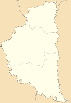
Zboriv (Ukrainian: Зборів, IPA: [ˈzbɔriu̯] ; Polish: Zborów; Yiddish: זבאָרעוו, romanized: Zbarev; Russian: Зборов, romanized: Zborov) is a small city in Ternopil Raion, Ternopil Oblast, western Ukraine. It is located in the historical region of Galicia. The local government is administered by Zboriv City Council.[1] Zboriv hosts the administration of Zboriv urban hromada, one of the hromadas of Ukraine.[2] Population: 6,621 (2022 estimate).[3]
The town (located 35 km (22 mi) northwest of Ternopil, and 85 km (53 mi) southeast of Lviv) lies on the Strypa River (Ukrainian: Cтpипа).
History
[edit]It was mentioned for the first time in a document from 1166. In 1241, during the Mongol invasion of Europe, it was ransacked and destroyed. In 1639, Zboriv was granted city rights.[citation needed] Its present name comes from a noble Polish family of Zborowscy.[4] Ten years later, Zboriv was besieged by the Tartar-Cossack armies during the Khmelnytsky Uprising.
In 1913, Zboriv had about 6000 inhabitants, including 2400 Ukrainians, 1300 Poles and 2300 Jews. During World War I, the town's vicinity was the site of heavy fighting between the Czechoslovak legionnaires and the Austrian Army (June 1917, Battle of Zborov). After the Polish-Ukrainian war 1918-1919, it became part of Poland and was the seat of a powiat of the Tarnopol Voivodeship.


In 1941, during World War II, Zboriv was the site of a mass murder conducted by Germans of the Einsatzgruppen, along with local Ukrainians. Information about the Jewish community destroyed during the Holocaust can be found in a Yizkor book published by Jews who fled Zborow and survived the Holocaust.
The town was completely destroyed in the summer of 1944 due to the Soviet offensive. Under Soviet rule (1944–1991), Zboriv was rebuilt and redeveloped. Construction plant and a small food processing factory were built in the 1960s.[citation needed] A significant part of the local budget relied on agriculture and governmental subsidies. The state farm in Zboriv was one of the best in the region. In the 1980s, the town became the object of serious governmental investments. Among these few new town improvements were built, like: cinema, agricultural market, new secondary school, waterbike lake station, football stadium, a city hall and a culture hall.
After the collapse of the Soviet Union, the local economy experienced a deep downturn. During the 1990s (until present time) as a result of economic decline many working-age people emigrated - mostly as a low-skilled labourers in Western Europe or Russia. Nowadays, in spite of the unfavorable conditions, the younger generation is less likely to quit and prefer to commute daily to work in the larger cities Ternopil and Lviv, which offer wider job opportunities.
Until 18 July 2020, Zboriv was the administrative center of Zboriv Raion. The raion was abolished in July 2020 as part of the administrative reform of Ukraine, which reduced the number of raions of Ternopil Oblast to three. The area of Zboriv Raion was merged into Ternopil Raion.[5][6]
Gallery
[edit]-
Church of New Martyrs of Ukrainian People (Orthodox)
-
Transfiguration Church (Catholic)
-
College
-
Bohdan Khmelnytskyi monument
-
Polish-Soviet War monument
Notable people
[edit]- Raphael Zaborovsky (1677–1747), Russian Orthodox bishop
- Mykola Skorodynskyi (1751–1805), Ukrainian Greek Catholic hierarch
- Milena Rudnytska (1892–1976), Ukrainian educator, women's activist, politician and writer
- Roman Pokora (1948–2021), Ukrainian football player
- Volodymyr Shandra (born 1963), Ukrainian politician and former Governor of Kyiv Oblast
- Ihor Kurylo (born 1993), Ukrainian football player
- Sviatoslav Dziadykevych (born 1995), Ukrainian football player
- Ivan Kohut (born 1998), Ukrainian football player
- Mykola Kohut (born 1998), Ukrainian football player
See also
[edit]References
[edit]- ^ Zborivska city council
- ^ "Зборовская громада" (in Russian). Портал об'єднаних громад України.
- ^ Чисельність наявного населення України на 1 січня 2022 [Number of Present Population of Ukraine, as of January 1, 2022] (PDF) (in Ukrainian and English). Kyiv: State Statistics Service of Ukraine. Archived (PDF) from the original on 4 July 2022.
- ^ Kucharski, Wojciech (2017). "Bitwa pod Zborowem 15–16 sierpnia 1649 r.". Studia z Dziejów Wojskowości (in Polish). 6: 74. ISSN 2299-3916.
- ^ "Про утворення та ліквідацію районів. Постанова Верховної Ради України № 807-ІХ". Голос України (in Ukrainian). 2020-07-18. Retrieved 2020-10-03.
- ^ "Нові райони: карти + склад" (in Ukrainian). Міністерство розвитку громад та територій України.


